Home Home
  • Home
  • 25 years
  • News
  • Sectors
    • City councils
      • Urban Information Portal (PIU)
      • WebGIS Activities and locations management
      • Castelló City Council
      • Sevilla city council
      • Tarragona City Council
    • Public authorities
      • Expropriation and Heritage Management
      • AMB SDI
      • Catalonia tourist geoapp
      • Puerto de Barcelona
      • Beaches of Mallorca
      • SIGME
      • VUIB
    • Mobility and sustainability
      • Smou
      • Mou-te
      • SPRO
      • TMB
    • Service networks
      • EMAFESA
      • GISAgua
      • WIBDH
    • Companies and businesses
      • Servihabitat
      • Pisos.com
      • CBRE
      • Windtec Energia Eòlica
    • Logistics
      • Eurofins Megalab
      • Interfacom
      • MOBA
      • Veosat
      • Race
      • M.Soft
      • M-Automoción
  • Tools
    • Cercalia
    • enMapa
    • Recitty
    • Custom solutions
    • Bus Manager
  • Contact
    • Contact
    • Work with us
Contact

Breadcrumb

  1. Home
  2. Node
  3. 311

BusManager.net, web platform to publish the public transport of a city in Google Maps

Submitted by admin on Sun, 04/21/2013 - 16:43
Image
Busmanager

Google Maps is an ideal tool for planning a trip with public transport. When users consult the map of the city, they can plan the trips combining all the different alternatives of public transport, besides the walking parts between the stops. This functionality is now available in more than 30 cities in Spain and in some 1.000 cities around the world.

For a city, uploading your public transport data to Google Maps is free. It is required to use the GTFS format and make a commitment to keep it updated. Google Inc has created free applications to edit and validate data in this format, like FeedValidator and ScheduleViewer. These are two applications that solve this process, but require a relatively high effort on the part of the technicians who use them.

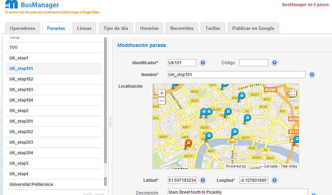
To simplify and automate the entire process, Nexus Geographics launched BusManager.net in April 2013. It is a web platform to create, manage and update the bus stops, itineraries, trips, routes and schedules necessary for the calculation of public transport routes on Google Maps, generating the standard GTFS files. This is a strategic service that is already being used by several Spanish cities and the company's future goal is to market it internationally.

Nexus Geographics has developed this application following the latest specifications of the GTFS format of Google and with the geographic web viewer based on the API of Cercalia.com.

Smart Mobility

Categories

Congress and conferences
Transport and infrastructure
NexusTeam
GIS Solutions for City Councils
Smart Mobility
City Councils
Awards
Spatial intelligence
Geolocation
Article
APPS

Related news

mapa obres barcelona
Tue, 02/11/2025 - 16:38
Interactive map of the Integral Maintenance Plan (PMI) of Barcelona
pisos
Tue, 02/20/2018 - 00:00
Maps with 3D buildings with apartments and houses on the real estate portal Pisos.com
ematsa
Fri, 02/09/2018 - 00:00
A Touch screen application to inform of field-work water samples
TUS
Mon, 01/15/2018 - 00:00
GIS system of mobility and public transportation of Sabadell
CONTACT
  • Barcelona Office
    Aragó 264 4, 08007 Barcelona
  • Guadalajara Office
    Av. Buendía 11, 19005 Guadalajara
  • Girona Office
    Joaquim Botet Sisó 6, 17003 Girona
  • +34 93 0172728
    [email protected]
  • TwitterYoutubeLinkedin Instagram
SECTORS
  • City councils
  • Public authorities
  • Mobility and sustainability
  • Service networks
  • Companies and businesses
  • Logistics
NEXUS
  • News
  • Work with us
  • Cercalia
  • enMapa
  • Recitty
  • Contact
OTHERS
  • BusManager
  • Routing Reparto
logo soclogo generalitatLogo eulogo next genenergia renovableENSPymeInnovadora

Support program: Grants for «última milla» digitalization projects in companies within the tourism sector.
For the project: Integrated management system for a bus operator within an intermodal network.
Funded by the Ministry of Industry and Tourism

logo eu esPlan de recuperación
aeonorISO
Sello PYME INNOVADORA 11/02/2028
PYME INNOVADORA
Válido hasta el 11 de febrero de 2028
escudo de MEIC 11/02/2028
  • Quality, Safety, and Environmental Policy
  • Cookies policy
  • Privacity policy
  • Legal advice
  • Home
  • 25 years
  • News
  • Sectors
    • City councils
    • Public authorities
    • Mobility and sustainability
    • Service networks
    • Companies and businesses
    • Logistics
  • Tools
    • Cercalia
    • enMapa
    • Recitty
    • Custom solutions
    • Bus Manager
  • Contact
    • Contact
    • Work with us