Home Home
  • Home
  • 25 years
  • News
  • Sectors
    • City councils
      • Urban Information Portal (PIU)
      • WebGIS Activities and locations management
      • Castelló City Council
      • Sevilla city council
      • Tarragona City Council
    • Public authorities
      • Expropriation and Heritage Management
      • AMB SDI
      • Catalonia tourist geoapp
      • Puerto de Barcelona
      • Beaches of Mallorca
      • SIGME
      • VUIB
    • Mobility and sustainability
      • Smou
      • Mou-te
      • SPRO
      • TMB
    • Service networks
      • EMAFESA
      • GISAgua
      • WIBDH
    • Companies and businesses
      • Servihabitat
      • Pisos.com
      • CBRE
      • Windtec Energia Eòlica
    • Logistics
      • Eurofins Megalab
      • Interfacom
      • MOBA
      • Veosat
      • Race
      • M.Soft
      • M-Automoción
  • Tools
    • Cercalia
    • enMapa
    • Recitty
    • Custom solutions
    • Bus Manager
  • Contact
    • Contact
    • Work with us
Contact

Breadcrumb

  1. Home
  2. StQBus new APP of Sant Cugat to know the services of public transport from the mobile

StQBus, new APP of Sant Cugat to know the services of public transport from the mobile

Submitted by admin on Fri, 09/06/2013 - 17:35
Image
SantQbus

The application incorporates a geolocation system that allows to visualize the stops closest to the user, to consult schedules and to obtain arrivals in real time from your mobile phone.

Sant Cugat is one of the first city councils to develop an application to consult urban bus services.

The City Council launches an application for smartphones that allows real time consultation of the bus transport in Sant Cugat. Thanks to the new application, users of public transport in the city will have access to a tool that will allow them to optimize routes, so that traveling by bus will be easier, faster and more comfortable.

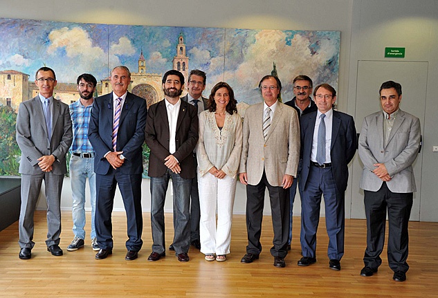
A presentation was held this afternoon with the presence of the Mayoress, Mercè Conesa, the Moventis CEO, Josep Maria Martí, the Managing Partner of Nexus Geographics, David Comas, and the Deputy Mayor for Mobility,  Jordi Puigneró.

The App, which was created by the company Nexus Geographics with the participation of the systems department of Moventis, is compatible with the Apple and Android systems. Since the beginning of September you can download the free app from the Google Play Store, and will be available early October on the Apple Store.

According to the mayor, Mercè Conesa, "this application will improve the bus service and, therefore, the quality of life of the citizens in Sant Cugat." Likewise, Conesa said that "the development of this application reflects the commitment of Sant Cugat to become a smart city: we gain in technology, efficiency and quality." The mayor also recalled that "the bus service of Sant Cugat has approximately 1.055.000 passengers per year, a figure that increases progressively and shows that the service is increasingly requested."

The Deputy Mayor of Governance, Security, Mobility and Technology, Jordi Puigneró, recalled that "thanks to this application, more and more citizens will be interested in public transport, which is a synonym for quality and efficiency ".

Moventis CEO Josep Maria Martí said: "This is a service that multiplies the information available to the user. Today, the City Council takes a step forward, a step that is also one of the users.”

The Managing Partner of Nexus Geographics, David Comas, presented the operation of the application and said that "it is one of the most technologically advanced."

The application allows to consult the complete offer of the bus network of Sant Cugat, schedule forecasts and arrival information in real time on smartphone and tablet. Likewise, through a geolocation system, the user can see which are the nearest stops with the distance expressed in meters. In addition, the general map of all the lines can be accessed and, from the bus stop icons, you can consult the schedules. Thanks to the Street View format, the user can explore the city with street images, panoramic views and also 360 degrees.

The list and itinerary of the bus lines can also be consulted from your mobile phone along with the schedules planned for all the lines in a particular stop. Thus, the user will be able to know in real time which bus lines he can pick up at the stop where he is and the time of arrival and departure of the buses.

According to data from the Sociological Observatory of December 2012, 46% of the population of Sant Cugat has a mobile phone with Internet connection. In addition, 90% of the population has a generally valued Internet connection. Only 10% of the citizens from Sant Cugat affirm that they do not have Internet at home.

Smart Mobility

Categories

Congress and conferences
Transport and infrastructure
NexusTeam
GIS Solutions for City Councils
Smart Mobility
City Councils
Awards
Spatial intelligence
Geolocation
Article
APPS

Related news

mapa obres barcelona
Tue, 02/11/2025 - 16:38
Interactive map of the Integral Maintenance Plan (PMI) of Barcelona
pisos
Tue, 02/20/2018 - 00:00
Maps with 3D buildings with apartments and houses on the real estate portal Pisos.com
ematsa
Fri, 02/09/2018 - 00:00
A Touch screen application to inform of field-work water samples
TUS
Mon, 01/15/2018 - 00:00
GIS system of mobility and public transportation of Sabadell
CONTACT
  • Barcelona Office
    Aragó 264 4, 08007 Barcelona
  • Guadalajara Office
    Av. Buendía 11, 19005 Guadalajara
  • Girona Office
    Joaquim Botet Sisó 6, 17003 Girona
  • +34 93 0172728
    [email protected]
  • TwitterYoutubeLinkedin Instagram
SECTORS
  • City councils
  • Public authorities
  • Mobility and sustainability
  • Service networks
  • Companies and businesses
  • Logistics
NEXUS
  • News
  • Work with us
  • Cercalia
  • enMapa
  • Recitty
  • Contact
OTHERS
  • BusManager
  • Routing Reparto
logo soclogo generalitatLogo eulogo next genenergia renovableENSPymeInnovadora

Support program: Grants for «última milla» digitalization projects in companies within the tourism sector.
For the project: Integrated management system for a bus operator within an intermodal network.
Funded by the Ministry of Industry and Tourism

logo eu esPlan de recuperación
aeonorISO
Sello PYME INNOVADORA 11/02/2028
PYME INNOVADORA
Válido hasta el 11 de febrero de 2028
escudo de MEIC 11/02/2028
  • Quality, Safety, and Environmental Policy
  • Cookies policy
  • Privacity policy
  • Legal advice
  • Home
  • 25 years
  • News
  • Sectors
    • City councils
    • Public authorities
    • Mobility and sustainability
    • Service networks
    • Companies and businesses
    • Logistics
  • Tools
    • Cercalia
    • enMapa
    • Recitty
    • Custom solutions
    • Bus Manager
  • Contact
    • Contact
    • Work with us